Localizing and Orienting Street Views Using Overhead Imagery
Nam N. Vo James Hays
Abstract
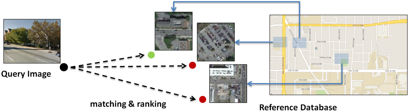
In this paper we aim to determine the
location and orientation of a ground-level query image by matching to a
reference database of overhead (e.g. satellite) images. For this task
we collect a new dataset with one million pairs of street view and
overhead images sampled from eleven U.S. cities. We explore several
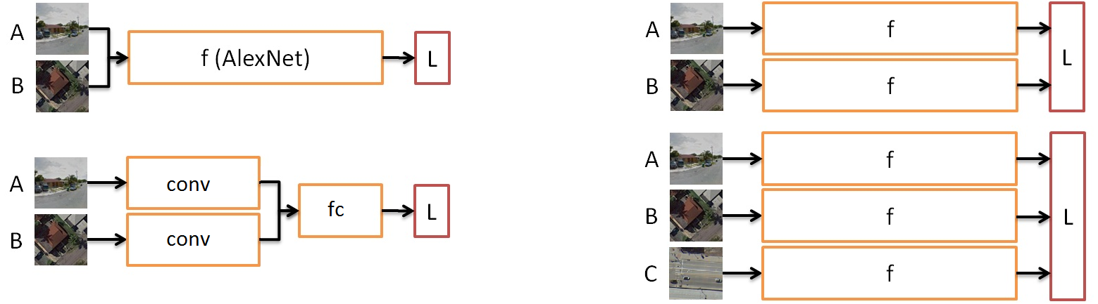
deep CNN architectures for cross-domain matching -- Classification,
Hybrid, Siamese, and Triplet networks. Classification and Hybrid
architectures are accurate but slow since they allow only partial
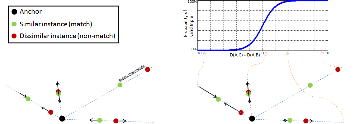
feature precomputation. We propose a new loss function which
significantly improves the accuracy of Siamese and Triplet embedding
networks while maintaining their applicability to large-scale retrieval
tasks like image geolocalization. This image matching task is
challenging not just because of the dramatic viewpoint difference
between ground-level and overhead imagery but because the orientation
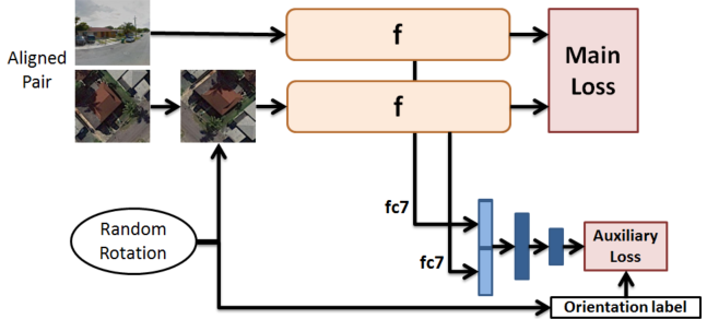
(i.e. azimuth) of the street views is unknown making correspondence
even more difficult. We examine several mechanisms to match in spite of
this -- training for rotation invariance, sampling possible rotations
at query time, and explicitly predicting relative rotation of ground
and overhead images with our deep networks. It turns out that explicit
orientation supervision \textit{also} improves matching accuracy. Our
best performing architectures are roughly 2.5 times as accurate as the
commonly used Siamese network baseline.
The problem & a new large scale dataset:
Deep network architectures experimented:
New distance based logistic log loss for Siamese & triplet
network
Rotation invariance by data augmentation & orientation
regression
Download
- Data & training code: GTCrossView
- Paper: Localizing and Orienting Street Views Using Overhead
Imagery, ECCV 2016
- poster